Greece
- Total Area: 131,957 sq. km.
- Land Area: 130,647 sq. km.
- Water Area: 1,310 sq. km
- Size Comparative to U.S. territory: Slightly smaller than Alabama
- Bordering Countries: Albania, Bulgaria, Turkey, Macedonia
- Total Distance of all Land Boundaries: 1,228 km
- Total Distance of Coastline: 13,676 km
- Description of Climate: Temperate; mild, wet winters and hot, dry summers
- Description of Terrain: mostly mountains with ranges extending into the sea as peninsulas or chains of islands
- Point of Lowest Elevation: Mediterranean Sea (0 m)
- Point of Highest Elevation: Mount Olympus (2,917 m)
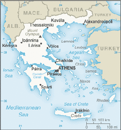
Country specific map of Greece
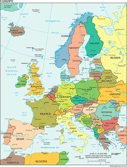
Regional Map of Greece: Europe
Google Map of Greece's Capital: Athens
